 geo.be Metadata Catalog
Land use
Type of resources
Available actions
Topics
INSPIRE themes
federalThemes
Keywords
Contact for the resource
Provided by
Years
Formats
Representation types
Update frequencies
status
Service types
Scale
Resolution
-

This web service allows viewing datasets from LandUse-Particular Zone
-

Points Of Interest - Natural elements contains point elements relating to nature, namely remarkable trees and underground cavities in Belgium.
-

Natura 2000 (N2K) is a network of core breeding and resting sites for rare and threatened species, as well as for some rare natural habitat types which are protected in their own right. It stretches across all 28 EU countries, both on land and at sea. The aim of the network is to ensure the long-term survival of Europe's most valuable and threatened species and habitats that are listed under the Birds Directive and the Habitats Directive. This dataset contains the sites in Belgium.
-

The Copernicus Urban Atlas (UA) provides European, comparable and detailed land use and land cover maps for the main Functional Urban Areas (FUAs). The Urban Atlas Street Tree Layer (UA-STL) is a separate layer of the Urban Atlas 2012. It includes contiguous rows or patches of trees covering 500 m² or more with a minimum width of 10 m within the urban mask of the Urban Atlas 2012. Gaps between tree patches or within a larger patch that are less than 10m wide are included in the Street Tree Layer. There is no thematic content other than the presence or absence of trees. The UA-STL is a new product and no accuracy threshold was provided as part of the Urban Atlas specifications. The UA STL product validated currently covers just over 7% of the total UA2012 area.
-
Landuse-Particular Zone is the INSPIRE 2D vector data set of the "Particular zones" layer originated from the Top10vector product of the National Geographic Institute in Belgium . It includes the "ExistingLandUseDataSet" features and the "ExistingLandUseObject" features in accordance with the INSPIRE specifications.
-

This web service allows viewing CORINE High Resolution Layers Belgium covering the Belgian territory within the framework of a Pan-European coverage. This service is compliant with the INSPIRE specifications.
-

CORINE Local Components is an INSPIRE compliant WMS service showing 4 "Local component products" covering the Belgian territory within the framework of a Pan-European coverage. The 4 layers cover 4 different products: Urban Atlas 2012, Urban Atlas 2012 Street Tree Layer, Riparian Zones and Natura2000.
-
The European Urban Atlas provides reliable, inter-comparable, high-resolution land use and land cover data for 800 Functional Urban Area (FUA) for the 2012 reference year in EEA39 countries. This datasets contains the FUA for Belgium (Antwerpen, Brugge, Bruxelles_Brussel, Charleroi, Gent, Kortrijk, Leuven, Liege, Mons, Namur and Oostende).
-
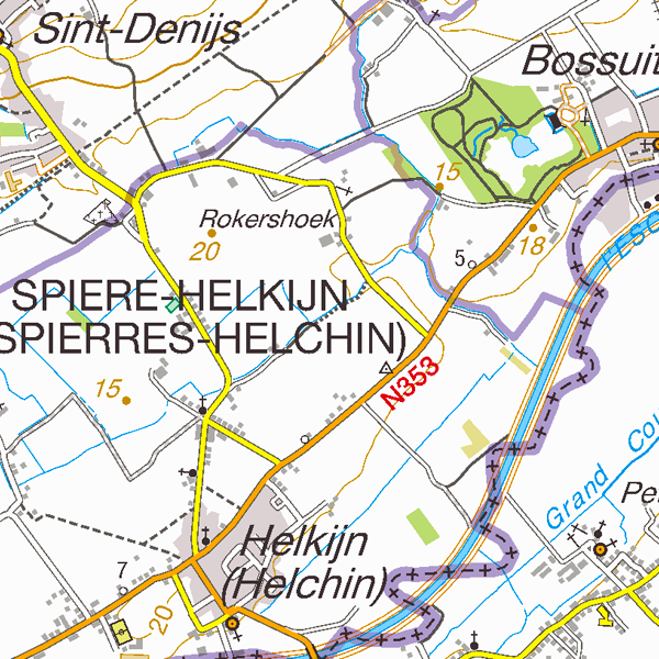
TopoMaps is a WMS allowing visualizing all images corresponding to the standard topographic cartographies made by the National Geographic Institute. As a result, it allows viewing cartographies on a 1:25 000 scale (Top25Map), on a 1:50 000 scale (Top50Map), on a 1:100 000 scale (Landcover100Map) and on a 1:250 000 scale (Top250Map), as well as the administrative map (AdminMap). With the exception of the administrative map, the cartographies show all themes of the topo-geographic inventory of the Belgian territory (ITGI) which is made and kept up-to-date by the National Geographic Institute: land use, transport, hydrography, buildings and constructions, relief, map lettering and toponyms.
-

Characteristics of the cadastral parcels - Rights of legal persons corresponds to the dataset describing the legal persons holding real rights on the parcels such as recorded by the FPS Finance for registration purposes. This dataset is composed of seven classes. The first class shows, at the national level, for each cadastral nature and for each type of real right, the number of parcels, their total cadastral income, as well as the number of parcels on which legal persons from the concerned NACE code hold the concerned real rights. The second class includes this information at the level of the three regions. The following classes do the same at the level of provinces, arrondissements, municipalities, cadastral divisions and statistical sectors. The dataset can be freely downloaded as a zipped CSV.